
Ait Bouguemez: The Complete Travel Guide (2026)
Last reviewed: September 2026 · key facts checked against Wikidata
Ait Bouguemez Travel Guide: Everything You Need to Know (2026)
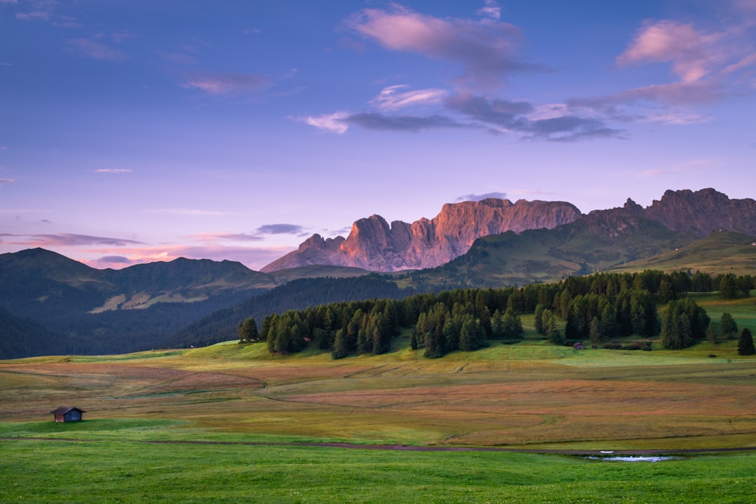
Ait Bouguemez, nicknamed ‘Happy Valley,’ sits at roughly 1,900 metres altitude in Morocco’s Central High Atlas Mountains, within the Azilal Province — one of the country’s most isolated yet rewarding trekking corridors. The valley stretches approximately 30 kilometres end to end, threading through a dozen Berber villages that have practised terrace farming for centuries. It receives a fraction of the visitors that flood Marrakech, making it one of the last genuinely untouched corners of Morocco accessible without a serious expedition.
Three Things Not to Miss in Ait Bouguemez
- Ibaqaliwn Granary (Agadir) — A pre-Islamic fortified communal granary perched on a rock — one of the best-preserved ighrem structures in the Atlas, over 500 years old.
- Trek to Ighil M’Goun Summit — Morocco’s second-highest peak at 4,068 metres launches directly from the valley, offering a 3-day circuit through dramatic Berber landscapes.
- Village of Agouti — The valley’s most photogenic village sits beside a turquoise irrigation canal with unobstructed Atlas panoramas at every turn.
Scroll down for our complete travel guide with tips on getting there, where to stay, costs and more.
Arriving in Ait Bouguemez: Airport & Transfers
How do I get to Ait Bouguemez?
The most reliable route is a shared taxi or private transfer from Azilal town, which itself is reachable by bus from Marrakech’s Bab Doukkala bus station. In my experience, take a CTM or Supratours bus to Azilal (roughly DH 60–80, journey 3–3.5 hours), then negotiate a grand taxi or 4WD from Azilal to Tabant village in the valley — about DH 120–180 per seat or DH 700–900 for a full vehicle. The road from Azilal is sealed but includes sharp mountain switchbacks that genuinely unsettle drivers in poor weather. I recommend arriving in Azilal by midday so you reach the valley before dark — afternoon departures frequently arrive after sunset.
Which airport is closest to Ait Bouguemez?
Marrakech Menara Airport (RAK) is the closest practical gateway, approximately 200 km southwest of the valley. In my experience, no airport sits meaningfully closer — Beni Mellal Airport (BEM) exists but has extremely limited international connections as of 2026. My tip: fly into RAK, spend one night in Marrakech’s Guéliz neighbourhood to recover from the flight, then head northeast toward Azilal the following morning. Attempting the full Marrakech-to-valley journey in a single day after a long-haul flight is exhausting and leaves you arriving at the guesthouse well after dinner. Factor DH 200–350 for airport transfers in Marrakech itself.
How long does the journey to Ait Bouguemez take from Marrakech?
Budget a full 5–6 hours door-to-door from central Marrakech. The Marrakech-to-Azilal leg by bus takes 3–3.5 hours; the Azilal-to-Tabant mountain road adds another 1.5–2 hours by grand taxi depending on road conditions. What surprised me: Google Maps consistently underestimates this by 40 minutes because it cannot account for the 27 hairpin bends on the final ascent. A private transfer all the way from Marrakech costs around DH 800–1,200 and cuts logistics considerably — worth splitting among 3–4 travellers. Avoid this route after heavy November–March snowfall, when the pass can close entirely with zero warning.
Do I need a car to explore Ait Bouguemez?
For the valley itself, no — walking between villages is the entire point. Tabant to Agouti on foot takes roughly 90 minutes on flat irrigation paths. However, reaching the valley without a car requires logistical patience involving two separate shared taxis. My tip: if you plan to visit multiple Atlas sites — say, Cascades d’Ouzoud en route — a rental car from Marrakech makes genuine sense. Daily rental rates from Marrakech agencies run DH 300–550 for a standard hatchback, but I strongly recommend a 4WD (DH 550–900/day) for the final unpaved sections leading to remote trailheads. Fuel stations disappear after Azilal, so fill up completely there.
Getting Around Ait Bouguemez
What are the best areas to stay in Ait Bouguemez?
Tabant is the valley’s administrative hub and has the highest concentration of guesthouses — ideal for first-timers who want reliable food and morning trekking access. Agouti, 8 kilometres west, offers a quieter, more photogenic setting and I recommend it for anyone spending 4+ nights. The village of Ibaqaliwn suits travellers specifically chasing the granary ruins — a couple of family-run gîtes sit within a 10-minute walk. Avoid booking on the eastern edge near Timit unless you have your own transport, as it sits 12 kilometres from the nearest trailheads and feels isolated without a vehicle. In my experience, Tabant is the safest base for a first visit.
What does accommodation cost per night in Ait Bouguemez?
Budget travellers pay DH 80–130 per person for a dormitory bed in a basic gîte d’étape, which almost always includes blankets and a shared Berber breakfast of bread, argan oil, and tea. Private double rooms in mid-range guesthouses like Auberge Chez Aicha in Tabant run DH 250–400 including half-board. There are no hotels in the Western sense — accommodation is entirely gîtes and family auberges. What surprised me: negotiating a half-board package (dinner + breakfast) is almost always better value than paying à la carte, typically saving DH 80–120 per person daily versus ordering separately. High-end eco-lodges with en-suite bathrooms charge DH 600–900 but must be reserved weeks ahead.
How far in advance should I book accommodation in Ait Bouguemez during high season?
Book at least 4–6 weeks ahead for July, August, and the Easter trekking window — the valley has a hard ceiling of perhaps 200 guest beds across all villages combined. In my experience, the best-reviewed gîtes in Agouti and Tabant fill completely by late June for August slots. Outside peak season — say, October–November — you can book 1–2 weeks out or occasionally arrive without a reservation, though I would not recommend turning up unannounced in a remote Atlas valley. Phone or WhatsApp bookings work better than email here; most owners respond within 24 hours on +212 numbers and some list on Booking.com but not all.
Are there special or unique accommodation types in Ait Bouguemez?
Yes — the authentic option is a Berber family gîte d’étape, where you sleep on floor mattresses in a communal room, share meals at a low table with other trekkers, and wake to fresh Atlas air at 1,900 metres. Several guesthouses have restored traditional pisé (rammed earth) architecture with carved cedar ceilings — Gîte Amalou in Agouti is a strong example. Some operators offer mule-supported wild camping at altitude above 3,000 metres, essentially a guided mobile camp costing DH 400–600 per person per night all-inclusive with a local guide. I recommend at least one night camping near the M’Goun plateau — it is a genuinely different experience from the village guesthouses.
Where to Stay in Ait Bouguemez
What are the must-see sights in Ait Bouguemez?
The Ibaqaliwn agadir (communal granary) is the valley’s single most important historical structure — a 15th-century fortified storehouse built into a cliff face that still contains original wooden locks. The M’Goun Massif trekking circuit starting from Tabant is non-negotiable for anyone physically capable; even a single day-hike toward the plateau at 2,800 metres is transformative. The traditional irrigation system (seguias) threading through the terraced fields deserves a slow walk — local farmers still manage water allocation by ancient rotational rules. My tip: hire a local guide from the Association des Guides de Tabant for DH 300–400 per day — they unlock conversations and pathways that independent visitors simply never find.
What can I experience for free in Ait Bouguemez?
Walking between all valley villages costs nothing and delivers the best photography in the Atlas — the path from Tabant to Agouti along the river takes 90 minutes and passes working mills, walnut orchards, and children in school. The weekly souk in Tabant (typically Sundays) is free to wander and shows genuine local commerce rather than tourist craft performance. Sunrise from any rooftop in the valley costs only lost sleep — the light on the surrounding 3,000-metre peaks at dawn is one of Morocco’s great free spectacles. What surprised me: the valley’s resident stork colony nesting on village walls requires zero effort to find and delights every visitor who stumbles across it.
Which day trips are possible from Ait Bouguemez?
The most rewarding day trip is the hike to Lac Izourar, a glacial lake sitting at approximately 2,400 metres — roughly 4–5 hours round trip from Tabant on a clear trail. The village of Zaouiat Ahansal, reachable by a full-day drive or a 2-day walk over the Tizi n’Ait Imi pass, opens access to dramatic canyon country near the Gorges du Dadès approach. A shorter option: the drive to Azilal town takes 90 minutes and connects to Cascades d’Ouzoud, Morocco’s highest waterfall at 110 metres, roughly 2.5 hours west. I recommend Ouzoud as a standalone day excursion only if you have private transport — the shared-taxi logistics make it a half-day of travel for a 1-hour waterfall visit.
What local specialities should I try in Ait Bouguemez?
Tafraout nut oil (argan-adjacent walnut oil) produced from local orchards is the valley’s most distinctive flavour — drizzled over bread at breakfast it bears no resemblance to the jarred versions sold in Marrakech medinas. The Berber tagine with dried figs and mountain herbs appears on almost every gîte dinner menu and is superior to its urban cousins because the valley lamb is genuinely pasture-reared at altitude. Amlou paste — roasted almonds, argan oil, and honey — is served thick and dark at breakfast. My tip: ask your gîte host specifically for trid (shredded pastry with chicken and caramelised onion) if staying 3+ nights; it is a celebration dish not always offered without a request.
Ait Bouguemez Highlights & Must-Sees
What makes Ait Bouguemez unique compared to other Moroccan destinations?
Ait Bouguemez is one of the only valley communities in Morocco where traditional Amazigh Berber culture operates entirely on its own terms, without the performance layer that tourism has imposed on destinations like Aït Benhaddou or the Draa Valley. The terraced agricultural system is still fully functional — not a museum exhibit — and roughly 12 distinct villages maintain separate dialect variations of Tachelhit Berber. At 1,900 metres, the summer climate is 10–15°C cooler than Marrakech, making it a legitimate heat escape. What surprised me: the valley produces a disproportionate number of Morocco’s professional mountain guides — local knowledge here is world-class and affordable at DH 300–400/day.
How many days should I plan for Ait Bouguemez?
Minimum 3 nights, ideally 5–7 nights for a meaningful experience. Two nights barely covers acclimatisation and one day hike. With 5 nights I recommend: Day 1 — settle into Tabant, walk to Agouti; Day 2 — guided hike to Lac Izourar; Day 3 — granary visit plus souk; Day 4–5 — multi-day ascent toward the M’Goun plateau with overnight camping. Trekkers doing the full M’Goun circuit need 7–10 nights in the valley and surroundings. The honest caveat: if you only have 2 nights, the travel time (nearly 6 hours from Marrakech) means you spend 40% of your trip on transport — extend the stay or reconsider.
When is the best time to visit Ait Bouguemez?
July and August offer the most reliable trekking conditions based on 5-year climate data — warm days, minimal precipitation, and snow-free passes above 3,000 metres. My personal preference is late September to mid-October, when the walnut and apple harvest turns the terraces golden, crowds thin dramatically, and daytime temperatures sit at a comfortable 18–22°C at valley level. Spring (April–May) is spectacular for wildflowers but passes can still carry snow requiring crampons. The honest warning: December through February brings genuine winter — temperatures drop below 0°C overnight, some guesthouses close entirely, and the Azilal road can ice over. Do not attempt a winter visit without confirmed open accommodation and 4WD transport.
Are there local festivals in Ait Bouguemez worth attending?
The Moussem of Sidi Moussa takes place in the valley typically in late August, a Berber religious gathering combining music, communal feasting, and trade that draws families from across the Azilal Province. It is not on any tourist calendar — ask your gîte host for exact dates, which shift with the lunar cycle. The wheat harvest period in June involves the whole community working the terraces collectively and is extraordinary to witness if you time it right. What surprised me: Amazigh New Year (Yennayer) in mid-January sees genuine celebrations in village homes — if you are invited into a family home during this period, accept without hesitation. No formal entrance fees apply to any of these events.
Eating & Drinking in Ait Bouguemez
How does weather in Ait Bouguemez affect activities?
At 1,900 metres, weather changes faster here than anywhere I have trekked in Morocco. Summer afternoons regularly produce afternoon thunderstorms above 2,500 metres even in July — start hikes before 7:00 AM and aim to descend by 13:00. Spring snowmelt makes river crossings on the M’Goun circuit genuinely dangerous in April; local guides know which crossings to avoid. Autumn fog settles in the valley floor for 2–3 hours after dawn but burns off completely by 09:00. My tip: pack a waterproof shell layer regardless of season — at altitude the margin between pleasant and hypothermic narrows to 45 minutes of cloud cover. Winter closes the valley to serious trekking entirely.
How crowded does Ait Bouguemez get in peak season?
Compared to destinations like Chefchaouen or Merzouga, Ait Bouguemez remains genuinely low-volume even in August. I estimate peak season sees 400–600 visitors valley-wide per week — enough to fill gîtes but not enough to create queues or erode the atmosphere. The granary at Ibaqaliwn occasionally sees 20–30 visitors simultaneously on weekend mornings in August, which is the single busiest moment in the valley’s tourist calendar. Weekdays in July and August feel almost entirely peaceful. The honest trade-off: that low crowding exists precisely because access is effortful — anyone who finds the valley ‘too hard to reach’ is indirectly protecting it for those who make the journey.
How safe is Ait Bouguemez for travellers?
In my experience, the valley is among the safest rural destinations in Morocco — petty theft is essentially unheard of in this community context, and solo female trekkers I have met there report feeling entirely comfortable on marked trails. The primary risks are environmental rather than human: altitude-related fatigue above 3,000 metres, sudden weather changes, and navigation errors on unmarked trails. Always register your trekking route with your gîte host and, for anything above 2,500 metres, hire a guide from the Association des Guides de Tabant (certified, insured, DH 300–400/day). The nearest hospital is in Azilal, a 90-minute drive — carry a personal first-aid kit and any prescription medication you require.
Is English widely spoken in Ait Bouguemez?
Less so than in Morocco’s cities — the working languages are Tachelhit Berber and Moroccan Darija Arabic, with French serving as the practical bridge for most travellers. English is spoken by guides who have worked with international trekking groups and by gîte owners catering to British or American clients — perhaps 30–40% of accommodation hosts can manage basic English. My tip: learn 10 words of Tachelhit before arriving — ‘tanmirt’ (thank you) and ‘marhba’ (welcome) will generate immediate warmth from locals that no French phrase achieves. Communication for food, accommodation, and hiking logistics is entirely manageable without French if you use gestures and maps, but French genuinely opens doors in negotiations and planning.
Practical Tips for Ait Bouguemez
What is the daily budget for travelling in Ait Bouguemez?
A comfortable mid-range day costs DH 350–500 per person covering half-board gîte accommodation (DH 250–350), one guide hour or entry activity (DH 50–100), and drinks. Budget trekkers in dormitory gîtes with shared meals spend as little as DH 150–200 per day all-in. The ceiling for a private room, guide, and mule support runs DH 700–900 per person daily. What surprised me: the valley is dramatically cheaper than equivalent mountain experiences in the Atlas Toubkal area near Imlil, where tourist infrastructure has inflated prices by roughly 40%. Carry sufficient DH cash from Azilal — there are no ATMs in the valley itself and card payment is non-existent.
How does public transport work in and around Ait Bouguemez?
There is no formal bus service into the valley — public transport ends at Azilal town, from which grand taxis (shared 4WD vehicles) cover the final 60 km mountain road to Tabant for DH 120–180 per seat. Within the valley, transport between villages is entirely on foot, by mule, or by occasional local vehicles making supply runs. My tip: the Sunday souk in Tabant generates the highest volume of onward shared taxis back toward Azilal — time your departure for Sunday morning if you are budget-conscious. Hiring a complete grand taxi from Azilal to your gîte costs DH 700–900 and is worthwhile for groups of 4+, eliminating the wait for seats to fill.
Which apps do you recommend for visiting Ait Bouguemez?
Maps.me with pre-downloaded Morocco offline maps is essential — Google Maps loses accuracy on mountain trails above 2,000 metres and has incomplete coverage of valley footpaths. Gaia GPS is the tool of choice among serious trekkers for the M’Goun circuit, with downloadable topographic layers that work without signal. For translation, Google Translate with Darija Arabic and French downloaded offline bridges most communication gaps. Windy.com gives more reliable Atlas Mountain weather forecasting than any Morocco-specific app — check it every evening for the following day’s conditions above 2,500 metres. WhatsApp is universally used by gîte owners for bookings — it is more reliable than email and most hosts respond within a few hours.
Ait Bouguemez at a Glance
| Currency | Moroccan dirham (DH) |
|---|---|
| Official language | Arabic, Standard Moroccan Tamazight |
| Time zone | UTC+01:00 |
Source: Wikidata, retrieved September 2026.
Morocco › Ait Bouguemez
More Destinations in Morocco
Essential Resources for Planning Your Trip to Ait Bouguemez
- Women of Ait Bouguemez: How Tourism Affects Identities — official visitor information, passes & events
- Wikipedia: Ait Bouguemez — history, geography & background
- Wikivoyage: Ait Bouguemez — community travel guide & practical tips
- Lac Izoughar | Morocco | Attractions — expert itineraries & travel inspiration
- Ait Bouguemez — TripAdvisor — hotels, restaurants & traveller reviews
- Ait Bouguemez – The Happy Valley — how to get around
- Numbeo: Cost of Living in Ait Bouguemez — current prices & cost comparison
- Timeanddate: Ait Bouguemez Weather & Climate — forecasts & climate statistics
More Perspectives on Ait Bouguemez
- Need Ait Bouguemez/Happy Valley Tips
- Morocco’s Bougmez Valley: An Unspoiled Shangri-La
- Ait Bouguemez – The Happy Valley
Ait Bouguemez Travel Videos
Watch these videos for a visual preview before your trip:
- Aït Bouguemez, Morocco’s Happy Valley
- Hiking in Morocco – Trip to Aït Bouguemez “Tabant”
- English version EP 4 Ait Bougumez Geoparc M’Goun
Ait Bouguemez Travel Discussions on Reddit
Real traveller experiences and community advice:
- Traveling and driving through High Atlas in December
- Independent trekking in the Atlas range – Route and …
- Ait bouguemez : the best destination for nature admirers
Data Sources
This page was compiled using data from Wikipedia, Wikidata, Open-Meteo (climate), Numbeo (cost of living) and REST Countries. Information is updated regularly.